
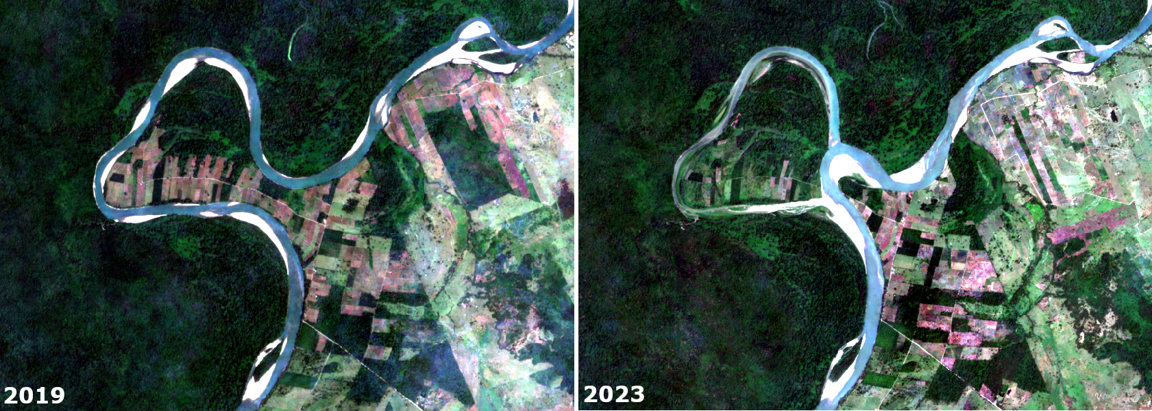
Sentinel-2 RGB composites clearly demonstrate how Lacantún River changed course between 2019 and 2023. In December 2020, the Lacantún River cut through a meander neck, forming an oxbow lake. The Lacantún River, located in southeast Mexico, constitutes the southeastern limit of the Montes Azules and Lacantún Biosphere Reserves. The western part of the image shows rainforest and wetland cover, while the eastern part shows remaining patches of rainforest, crops and cultivated grasslands.